
STORMCAST 2015: OUTRAGEOUS SNOW STORM LINUS COMING SUPER BOWL SUNDAY... or, You Know, Rain
AND HERE IT COMES AGAIN.
They’re forecasting snow – potentially a lot of it – for Sunday night into Monday. Just how much? John Bolaris has been ahead of this one again and predicts 6+ for much of our area.
Done deal?
Haha. No.
Why not?
Because weather people.
For reals.
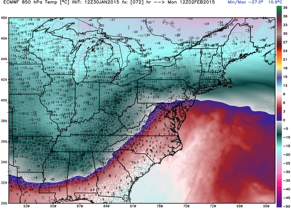
There’s no doubt this is a major system that will impact much of the East Coast, but unlike the last one, this one will be a rain-snow event, and where the freezing line falls will determine what sort of precipitation drips from the clouds and lands on your lawn. This temperature map (which I guarantee you is not the appropriate technical term) from meteorologist Ryan Maue puts Philly pretty much right on the freezing line, with most of the area at or below 32 (F):
So that means snow?
Probably. J-Bo notes that confidence is HIGH with this storm, but the models have been trending north, which at the moment actually sets our area up for a pretty significant snow storm. However, if that trend continues, the warm air could push up into the city and lead to more of a WINTRY MIX in Philly, with the north and west suburbs still looking at snow. PhillyWx.com says it’ll be close, but leans toward Philly being in the snow zone. Steven DiMartino predicts that the areas just north of the rain-snow line will get the most snow. Right now, that’s the Philly area. He predicts heavy sleet for the mix areas.
How much snow?
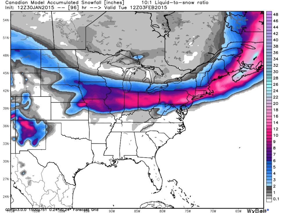
Well, Bolaris seems confident in 6+ for areas just north of rain-snow line, and agreeing models put that number at upwards of 12-14 inches, as you can see above. But that’s using a 10-to-1 liquid-to-snow ratio, an estimate that, as I’ve learned, can vary greatly depending on how wet or dry the snow is. Warmer–wetter (lower ratio). Colder–drier. Since we’ll be right on the freezing line, I’m guessing that 10-to-1 liquid-to-snow ratio will be a bit high, so those 12-14 estimates seem to be the absolute max. The National Weather Service, which also overshot its wad last time, is being more conservative this time around. Their local chief, my man Gary Szatkowski, predicts 4-6 for most of our area (though his forecast is from much earlier on Friday). Again– lots of consensus around the 6 number.
What about Adam Joseph and Cecily Tynan?
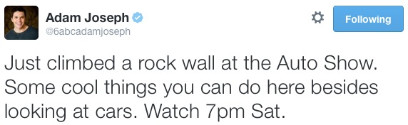
Once again, they’re far on the conservative side– going no further than to predict a mix and pointing out that there remains A LOT of uncertainty (surprise!) due to the path of that rain-snow line. Then again, the latest update from Adam came from a rock wall, so…
Sheena?

I’m sure some of you out there are feet people. I’m not (a foot person).
What’s the storm’s name again?
Good grief?
Sure.